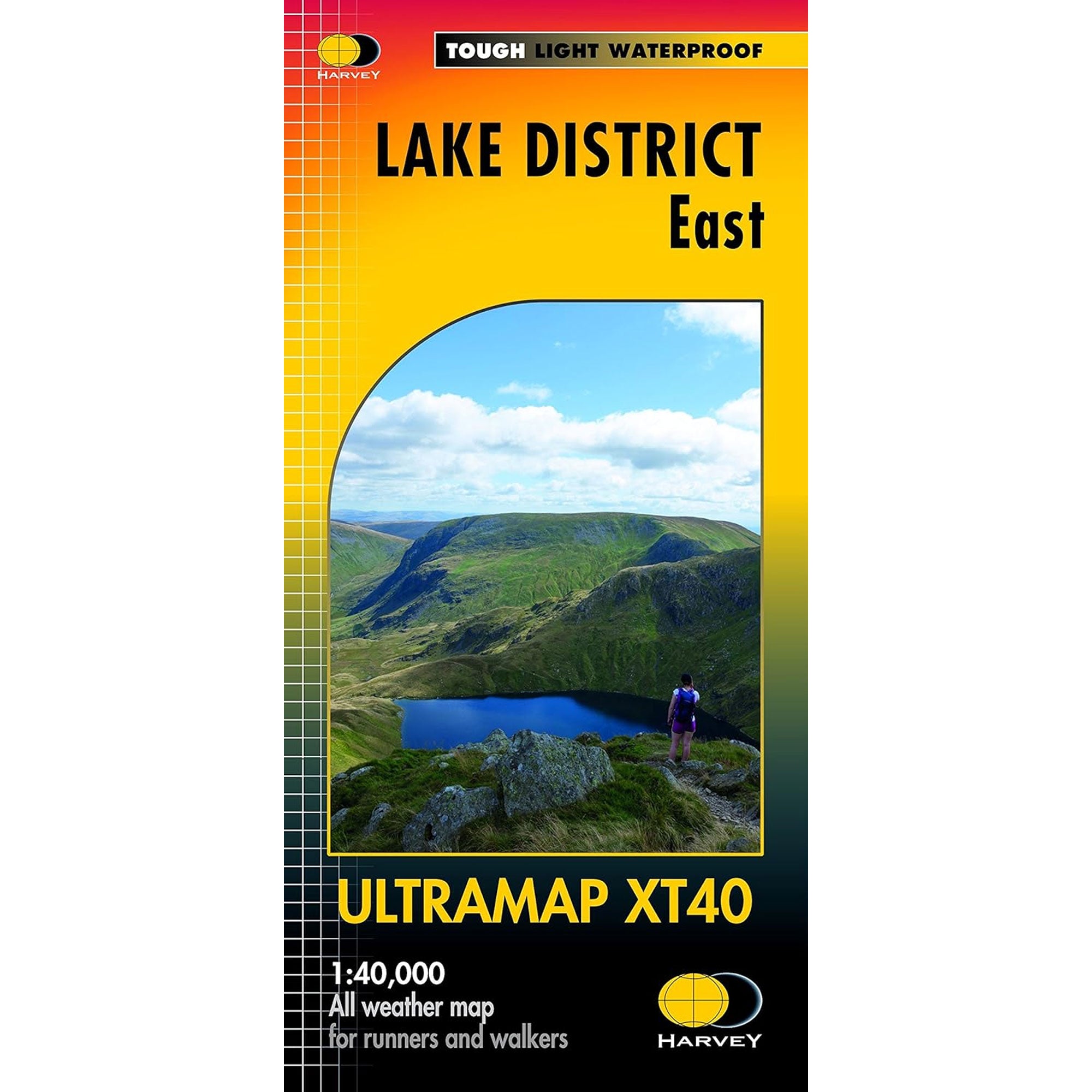
Ultramap Xt40 Map: Lake District East
- Regular price
-
£11.50 - Regular price
-
£11.50 - Sale price
-
£11.50
Couldn't load pickup availability
Description
Item Code: MA-280_2313
Covers a large area yet is handily compact. Pocket perfect!
Detailed map for runners and walkers of the eastern fells of the Lake District National Park at the magic scale of 1:40,000.
Features Helvellyn, High Street and fells east of the Kendal-Keswick road. The Kirkstone Pass, Ullswater, Haweswater and Kentmere are on this sheet.
Includes 82 Wainwrights.
Includes Rights of Way
Use without a map case: tough and 100% waterproof
Opens directly to either side of the sheet
DELIVERY & RETURNS
Delivery
DPD Next Day Delivery (Orders under £75) - £4.95
DPD Next Day Delivery (Orders over £75) - FREE
Order before 1:30pm for Next Working Day Delivery (weekends not included)
DPD Saturday Delivery - £15.95
Order before 1:30pm on Friday for Next Day Delivery
Royal Mail Highlands & Islands (Orders under £75) - £4.95
Royal Mail Highlands & Islands (Orders over £75) - FREE
Order before 1:30pm for same day shipping
Usually takes 1-2 working days
Returns
Policy:
If you're not 100% satisfied with your purchase we'll be more than happy to help you with an exchange or refund. All items purchased online are eligible for a refund or exchange provided that they are returned to us within 28 days in their original condition with all tags attached.
How to Return:
We do not currently offer a free returns label so we suggest using a Royal Mail Signed For service to return goods to ourselves, and parcels are insured at your own risk. Alternatively you may return your order to one of our stores should you live locally.
Return Address:
Epicentre, Compston Rd, Ambleside, LA22 9DR